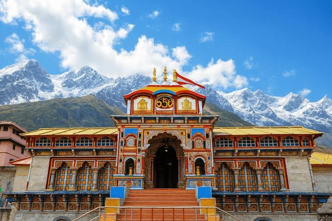
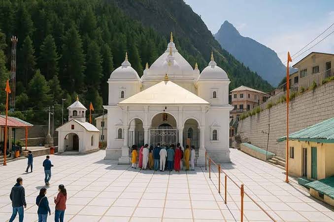
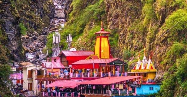
What Is the Current Status of the Char Dham Road Project? | Char Dham Yatra by Road 2027
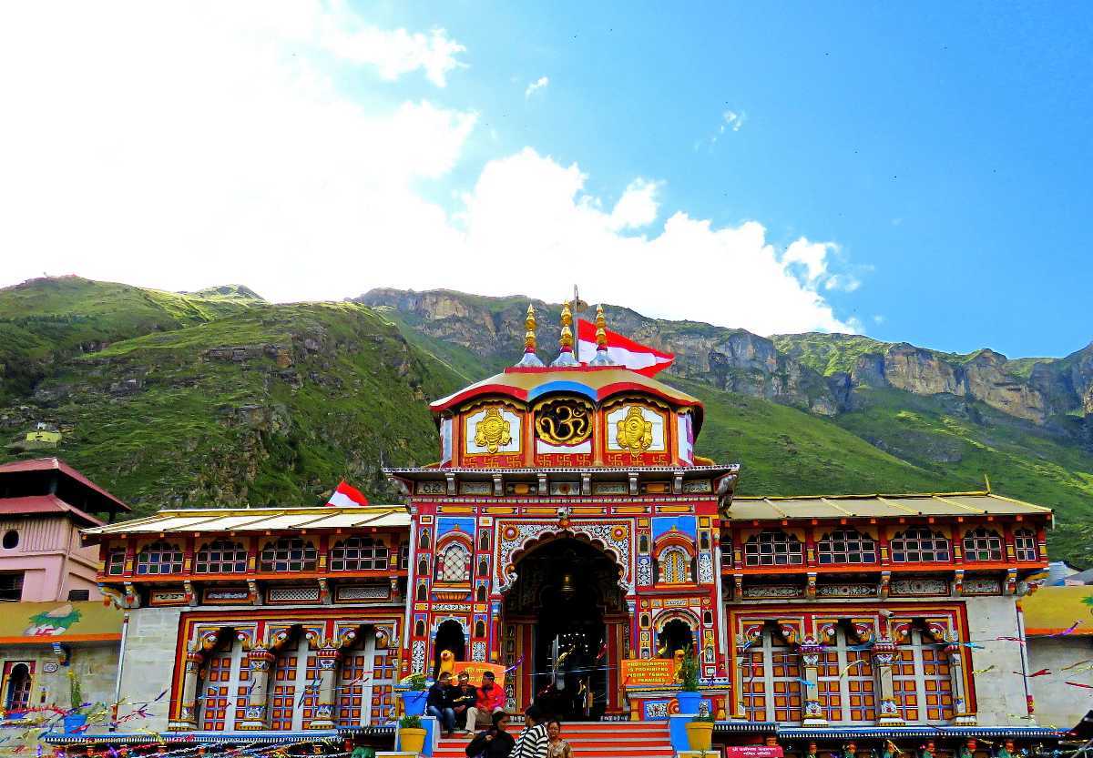
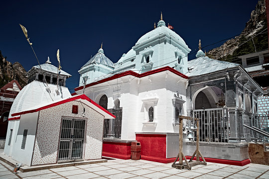
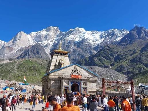
If you are planning a Char Dham Yatra by road in 2027, one of the most important questions is the current condition and development status of the roads connecting Yamunotri, Gangotri, Kedarnath and Badrinath.
The Char Dham Mahamarg Vikas Pariyojana is a major highway-development programme intended to improve connectivity to the Char Dham pilgrimage destinations in Uttarakhand.
As of the latest government information available in August 2026, the project covers about 825 km of existing National Highways, of which approximately 640 km has been completed. Work continues on the remaining sections.
This means the Char Dham road network has seen substantial development, but travellers should not interpret the project as meaning that every kilometre of the entire Char Dham route is completely finished or free from construction and weather-related disruption.
Road infrastructure is continuing to improve, but Himalayan travel can still be affected by weather, landslides, construction and local restrictions. Read our latest Char Dham Road Project Status update before planning your 2027 road journey.
Quick Answer: What Is the Current Status of the Char Dham Road Project?
The Char Dham Mahamarg Vikas Pariyojana is substantially progressed but not completely finished.
According to the latest Ministry of Road Transport and Highways information:
- Total project length: approximately 825 km
- Completed: approximately 640 km
- Remaining: approximately 185 km
- Project: Char Dham Mahamarg Vikas Pariyojana
- Region: Uttarakhand
- Purpose: improve connectivity to the Char Dham shrines and associated pilgrimage routes
The government has identified difficult Himalayan terrain, landslides, adverse weather, land acquisition and forest clearances among the challenges affecting implementation.
For travellers, the practical message is simple:
Road connectivity has improved significantly, but Himalayan travel still requires flexibility.
What Is the Char Dham Mahamarg Vikas Pariyojana?
The Char Dham Mahamarg Vikas Pariyojana is a major highway-development programme involving improvements to existing National Highways connecting the Char Dham pilgrimage region.
The project covers routes associated with:
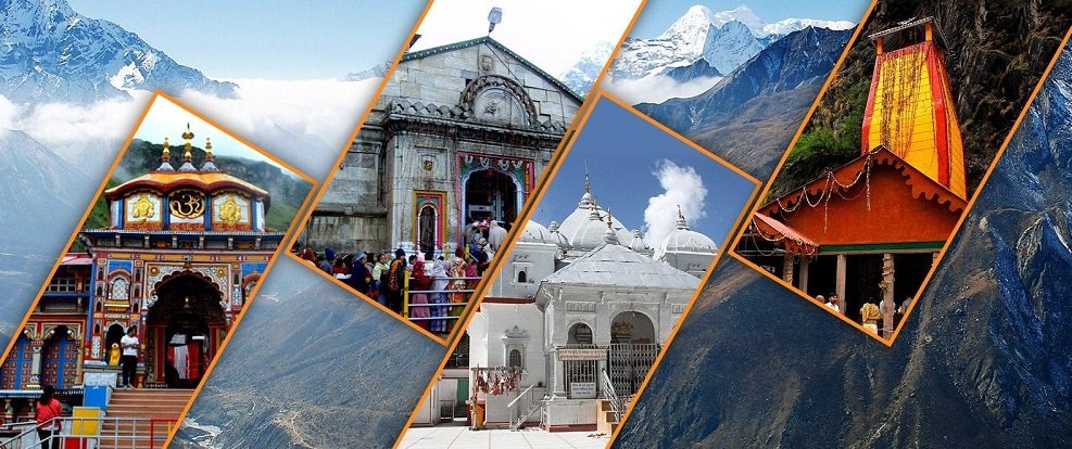
- Yamunotri
- Gangotri
- Kedarnath
- Badrinath
It also includes the Tanakpur–Pithoragarh section associated with the Kailash-Mansarovar route. The overall project length is approximately 825 km.
The objective is not simply to make the journey faster.
The broader aim includes improving:
- Road connectivity
- Travel reliability
- Safety
- Highway infrastructure
- Bridge infrastructure
- Slope protection
- Landslide mitigation
- Pilgrimage connectivity
How Much of the Char Dham Road Project Is Complete?
The latest government response available in August 2026 states that approximately 640 km of the 825 km project length has been completed.
That represents roughly 78% of the project length.
The remaining sections continue to involve construction and related infrastructure work.
Project snapshot
| Particular |
Current Status |
| Total project length |
Approx. 825 km |
| Completed |
Approx. 640 km |
| Remaining |
Approx. 185 km |
| Overall status |
Major progress, work ongoing |
| Terrain |
Himalayan/mountainous |
| Main challenges |
Landslides, weather, clearances, difficult terrain |
This percentage should be understood as overall project progress, not as a statement that every individual Char Dham road section is 78% complete.
Are All Char Dham Roads Now All-Weather Roads?
This is an important distinction.
The term “all-weather road” is commonly used when discussing the project, but it should not be interpreted by travellers as a guarantee that roads will remain open under every weather condition.
Heavy rainfall, landslides, rockfall, snow, road damage, construction activity or temporary government restrictions can still affect mountain roads.
The latest government response specifically identifies frequent landslides and adverse weather conditions among the implementation challenges.
Therefore, even after infrastructure improvements, travellers should check the latest road status before beginning a journey.
What Are the Major Road Projects Still Underway?
Several sections of the broader Char Dham road-development programme remain ongoing.
For example, NHIDCL currently lists multiple Rishikesh–Mana corridor packages as ongoing.
Lameri–Karanprayag
The NHIDCL listing for the Lameri–Karanprayag section identifies the project as ongoing under the Char Dham Pariyojana.
Karanprayag–Chamoli
The Karanprayag–Chamoli package is also listed as ongoing.
Chamoli–Paini
The Chamoli–Paini package is likewise listed as ongoing under the Rishikesh–Mana corridor.
Gholtir landslide section
A separate Gholtir landslide-related package is listed as Completed/DLP, showing that some individual components have already moved beyond active construction.
This illustrates an important point:
The Char Dham road project is not one single construction site. It consists of multiple packages and road sections at different stages of completion.
Is the Rishikesh–Badrinath Route Improving?
Yes, infrastructure development continues along the broader Rishikesh–Badrinath corridor.
One notable recent development is a 900-metre tunnel in Rudraprayag, along with a planned/near-completion bridge over the Alaknanda River, intended to improve connectivity between the Badrinath and Kedarnath highway links. The tunnel had been completed by July 2026, with vehicle trials reported as part of the process toward opening.
Such projects can improve traffic movement and reduce bottlenecks once fully operational.
However, travellers should still check the road situation for their actual travel date rather than assuming that completion of one infrastructure project means the entire route is free of restrictions.
What Are the Main Challenges Facing the Char Dham Road Project?
Building highways in the Himalayas is considerably more complicated than highway construction on flatter terrain.
The government has identified several major challenges.
1. Difficult Himalayan Terrain
Mountain roads require extensive slope cutting, retaining structures, bridges and geological assessment.
2. Landslides
Landslides remain an important risk during periods of heavy rainfall.
3. Adverse Weather
Rain, snowfall and other weather conditions can affect both construction and road operations.
4. Forest Clearances
Some sections require the relevant environmental and forest approvals before work can progress.
5. Land Acquisition
Land acquisition can affect construction timelines.
6. Environmental and Ecological Concerns
The project operates within a sensitive Himalayan environment.
The government has described measures involving environmental assessment, slope protection, landslide treatment and geohazard mitigation.
What Is Being Done to Improve Landslide Safety?
This is particularly relevant for travellers planning a road-based pilgrimage.
The government has taken several measures relating to:
- Landslide treatment
- Hill-slope protection
- Construction practices in mountainous terrain
- Rockfall mitigation
- Early-warning systems
- Geological investigations
- Geohazard monitoring
The Ministry has also reported collaboration with organisations including THDCIL, DGRE and Geological Survey of India, along with research collaboration involving IIT Roorkee for hill-slope instability assessment and monitoring.
These measures are important because improving the Char Dham road network is not only about widening roads—it is also about making mountain infrastructure more resilient.
Will the Char Dham Road Project Be Complete Before the 2027 Yatra?
It would be inappropriate to guarantee that the entire 825 km programme will be fully complete before the 2027 pilgrimage season unless the authorities officially provide such a completion commitment.
The latest official information confirms substantial progress but also confirms that work remains ongoing.
For travellers planning Char Dham Yatra 2027, the better approach is to monitor:
- Section-wise construction progress
- Road opening status
- Landslide-prone areas
- Weather advisories
- Traffic restrictions
- Government travel advisories
- Local administration updates
What Does the Road Project Mean for Char Dham Yatra 2027?
For pilgrims, continued road development can potentially bring several benefits.
Better connectivity
Improved road infrastructure can make access to pilgrimage destinations easier.
Improved road geometry
Upgraded sections can provide better-designed road infrastructure where completed.
Better bridges and tunnels
New structures can help reduce bottlenecks on specific sections.
Improved slope protection
Engineering and mitigation measures can help address some landslide-prone areas.
Better travel planning
As infrastructure develops, journey planning can become more predictable on completed sections.
However, mountain travel will always remain weather-sensitive.
Is Char Dham Yatra by Road 2027 Safe?
Safety should be considered on a date-by-date basis, not simply from the overall project completion percentage.
For a road-based Char Dham journey, travellers should check:
- Current road conditions
- Weather forecast
- Landslide alerts
- Traffic restrictions
- Local administration advisories
- Vehicle condition
- Driver experience
- Travel itinerary
- Buffer time
A professional hill driver and a realistic itinerary are particularly important for long Himalayan journeys.
ABD Holidays currently plans its Char Dham Yatra by Road 2027 around a typical 9 Nights / 10 Days Haridwar-to-Haridwar itinerary, while allowing travel arrangements to be adjusted according to current conditions.
Char Dham Yatra by Road 2027: Typical Route
A traditional road itinerary can follow:
Haridwar → Barkot → Yamunotri → Uttarkashi → Gangotri → Guptkashi/Phata → Kedarnath → Badrinath → Srinagar → Haridwar
The exact route can change according to:
- Road conditions
- Weather
- Traffic
- Construction
- Local restrictions
- Government advisories
Travellers should not plan Himalayan journeys solely by calculating the shortest distance.
Mountain travel time is affected by terrain, traffic, road conditions and stops.
Should You Choose Road or Helicopter for Char Dham Yatra 2027?
The answer depends on your travel requirements.
Choose Road if:
- You have sufficient time.
- You want to experience the Himalayan journey.
- You prefer private vehicle travel.
- You are travelling with family or a group.
- You want greater flexibility in road stops.
Consider Helicopter if:
- You have limited time.
- You want to reduce long mountain road journeys.
- You prefer a premium travel arrangement.
- The helicopter itinerary is suitable for your group.
ABD Holidays also provides information for travellers comparing Char Dham Yatra by Road vs Helicopter.
What Should Travellers Check Before Starting Char Dham Yatra 2027?
Even with improved highways, a responsible traveller should check the latest information shortly before departure.
Road Status
Check the latest status of your specific route.
Weather
Mountain weather can change quickly.
Registration
Follow the applicable Char Dham registration requirements for 2027.
Temple Schedule
Confirm the officially announced temple opening and closing schedules.
Vehicle
Choose a vehicle appropriate for the number of passengers and luggage.
Driver
For a Himalayan road journey, experienced mountain driving is important.
Buffer Day
Keeping some flexibility is useful because weather and road conditions can change.
Char Dham Road Project and Local Uttarakhand Travel
The road-development programme is important not only for pilgrims but also for the wider Uttarakhand tourism economy.
Better connectivity can benefit travel between:
- Haridwar
- Rishikesh
- Uttarkashi
- Barkot
- Gangotri
- Guptkashi
- Kedarnath region
- Rudraprayag
- Chamoli
- Badrinath
- Mana
For travellers requiring private transportation, ABD Holidays also provides Uttarakhand Taxi Service, including vehicles for pilgrimage and family travel.
Char Dham Road Project: What Travellers Should Remember
The most important point is that “project progress” and “today's road status” are two different things.
A highway section can be substantially upgraded while a temporary landslide, rainfall event, construction activity or traffic restriction affects the route on a particular day.
Therefore:
For Char Dham Yatra 2027, use the overall road-project progress as background information, but make your final travel decision based on the latest route-specific conditions.
Frequently Asked Questions
What is the current status of the Char Dham road project?
As of the latest government information available in August 2026, approximately 640 km of the 825 km Char Dham Mahamarg Vikas Pariyojana has been completed, while work continues on the remaining sections.
Is the Char Dham road project fully complete?
No. The overall project has made substantial progress, but approximately 185 km remains to be completed or addressed within the reported project scope. Different individual packages are at different stages.
Will Char Dham roads be better for the 2027 Yatra?
Infrastructure improvements are expected to benefit completed sections, but travellers should not assume that every section will have identical conditions. Weather, landslides, construction and local restrictions can still affect travel.
Is the Char Dham road an all-weather road?
The project is intended to improve all-weather connectivity, but “all-weather” should not be interpreted as a guarantee that roads will remain open during every extreme weather event. Himalayan roads can still be affected by landslides, heavy rainfall, snowfall and other conditions.
Which Char Dham road sections are still under construction?
Several packages under the Rishikesh–Mana corridor remain listed as ongoing by NHIDCL, including Lameri–Karanprayag, Karanprayag–Chamoli and Chamoli–Paini.
Can I travel Char Dham by road in 2027?
Yes, road travel remains an important way to undertake the pilgrimage. However, travellers should check the latest route conditions, weather, registration requirements and government advisories before departure.
How many days are required for Char Dham Yatra by road?
A commonly planned complete road itinerary is around 9 Nights / 10 Days from Haridwar, although the appropriate duration depends on the route, rest requirements, weather and traveller profile.
Should I keep a buffer day for Char Dham Yatra?
Yes. A buffer can be useful because Himalayan weather, road conditions, traffic and temporary restrictions can affect the planned schedule.
Plan Your Char Dham Yatra by Road 2027 with ABD Holidays
A road-based Char Dham pilgrimage is not only about reaching the four temples. The journey itself passes through the Himalayan landscape of Uttarakhand.
ABD Holidays provides Char Dham Yatra by Road 2027, private taxi arrangements, group vehicles, accommodation coordination and customized pilgrimage planning from Uttarakhand.
Explore:
For a road journey, share your travel dates, number of passengers, starting point and preferred vehicle category so the itinerary can be planned according to the applicable 2027 conditions.
Final Word
The Char Dham road network has undergone significant development, with approximately 640 km of the 825 km project reported complete as of August 2026.
But Uttarakhand's Himalayan terrain means that road conditions will continue to depend on weather, geology, construction activity and local conditions.
For Char Dham Yatra by Road 2027, the smartest approach is therefore:
Plan early → choose the right vehicle → allow buffer time → monitor route conditions → check official advisories before departure.
This gives pilgrims the benefits of the improving road network without assuming that Himalayan travel can ever be completely predictable.
Jai Badri Vishal!